
"One should always have a
definite objective, in a walk as in life — it is so much more satisfying to
reach a target by personal effort than to wander aimlessly."
-
Alfred Wainwright

Day
Two: From Ennerdale Bridge to Rosthwaite (16 miles/26 km)
Summary of Route:
Now you are into the Lake District National Park for the next four days. There
is a lot of high-climbing to come.The first half of this stage is a walk along
the southern side of Ennerdale Water. At the end of the Water, you cross to the
northern bank of the River Liza.
Just after the
Ennerdale Camping Barn, there is a choice of trail — the low route through the
valley, or the high route, which passes Red Pike, High Stiles, High Crag and
Hay Stacks.
Near the end of the
high route you reach Innominate Tarn: Alfred Wainwright asked that his cremated
remains be disposed of here — "where the water gently laps the gravelly
shore and the heather blooms and Pillar and Gable keep unfailing watch."
This alternate, high
route adds about one-and-a-half miles (2.5 km) and 1¾ hours to the regular
walk. After the YHA Black Sail, the low route turns north and climbs steeply up
Loft Beck. Just after turning east again, it meets the high route just beyond
the Blackbeck Tarn. From here the trail begins
a long descent through Honister, Seatoller and Longthwaite, before finally
arriving in Rosthwaite (which sits in the civil parish of Borrowdale).
 |
| Walking along the southern shore of Ennerdale Water |
Today was a day of recovery.
I was able to "walk through" the sore legs and feet resulting from
yesterday's brutal re-introduction to long-distance hiking, and get to this
day's destination without the physical difficulties suffered during Day One of
the Coast to Coast Walk.
 |
| Lots of purple heather along EnnerdaleWater |
The scenery on this day's
hike — the first stage within the Lake District National Park — was spectacular.
We started the day walking along the entire southern shore of Ennerdale Water.
All along the trail we encountered engorged brooks flowing down the steep sides
of the fell into the lake. The rushing sound of water tumbling over rock-festooned
stream-beds is a tonic to the soul.
 |
| A tricky climb down a rocky bit on southern shore of Ennerdale Water |
A lot of the stony trail along
Ennerdale Water (especially the eastern half) was covered in very shallow, slow
moving water — not a problem if you are wearing good hiking boots.
 |
| A gate along Ennerdale Water |
 |
| Ennerdale Water |
Once passed the end of
Ennerdale, we followed a gravel road for a couple of miles along the northern side of the Liza
River. This track went through a forest plantation. It was a rather tedious and
uninteresting section of the walk. The three of us began to string out along the
path, often some 75-100 yards apart. For periods like this, you get lost in your
own thoughts: checking out the scenery, anticipating the landscape features to
come, assessing your physical condition, thinking about what is behind you
already, and what is still to come.
 |
| In the meadow just beyond the eastern end of Ennerdale Water |
There is a strong psychological
component to this sort of adventure. You constantly second-guess your
motivation and your abilities. But your companions work to encourage and
inspire you. And periods of self-doubt and physical difficulty are off-set by other
periods of pleasure and elation.
Quote of the Day:
"Clive, liberate yourself with a camera-free
day"
- Tony (who took several
pictures with his smart phone!)
At the end of the forest
trek, expansive vistas opened up, revealing the heights of many Lakeland fells.
We soon stopped for about 20 minutes to eat our lunch beside a small stream flowing
down into the valley below us.
 |
| Tony and Michael have lunch |
From this point to the Honister
Slate mines (about four miles), the trail took us through a spectacular landscape.
We continued east along the valley, with high crags above us, and rushing
streams below. We passed a section of many small drumlins (mounds left through
glacial deposits). And then we began a steep ascent up to the summit of
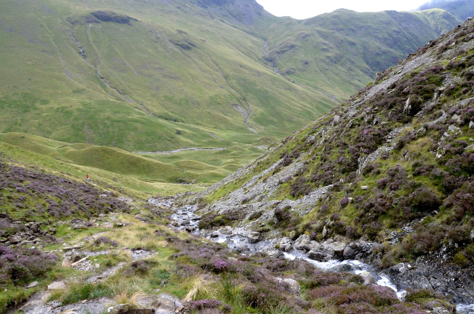
Brandreth, with a beautiful mountain stream — Loft Beck — cascading down the
very steep fell.
 |
| Valley below Loft Beck showing a group of glacial-deposit drumlins |
At the top we continued
across Grey Knotts — a beautiful walk in the sunshine, with a dramatic vista to
the west, showing the lakes of Buttermere and Crummock Water. A slow descent took
us in a wide north-west arc down the fell, until we met the trail that would
take us due-east along the now-abandoned Honister Slate Mine tramway. This part
of the trail was full of slate rock — a difficult surface to walk, especially
as it also dropped precipitously down to the road.
 |
| Climbing towards Loft Beck |
We stopped at a tea shop
beside the Slate Mine Museum and enjoyed a very welcome mug of tea and a piece
of cake. From this point on we continued to hike down the fell, on a grassy,
meadow-like surface, decorated now and then by the odd sheep, on along march
towards Rosthwaite, a small hamlet in Borrowdale.
 |
| Looking down into the valley during the hike up beside Loft Beck |
Today has been full of
wonderful Lakeland landscapes. And I got the sense that, despite the dramatic
aches and pains of yesterday's walking, I can do this! There should be a lot
more splendid Lakeland vistas tomorrow.
 |
| A view of Buttermere Lake and Crummock Water (behind) |
"Make
your feet your friend" - J.M.
Barrie
 |
| Walking down the old Honister Slate Mine tramway |
Dedication
This hike is dedicated to
Bill and Barb Cannon.
(see
the end of my blog post for Day One for details)
 |
| A ram on the meadows above Borrowdale |
Resources:
Coast
to Coast Path (Sixth Edition - 2014) by Henry Stedman;
Coast to Coast: West -
Harvey Map XT40
I'm enjoying the photographs. Splendid.
ReplyDeleteHope everyone's legs are now over the early pain!
Well done, Clive and thank you for dedicating this part of the trip to my parents. I am sure they would love to join you, Tony and Michael for the entire adventure, as would I, if time permitted. Your photos remind me of places I visited there so many years ago. Best wishes to the three of you. Looking forward to more photos and info. Bill.
ReplyDeleteLove these photos Clive. I especially love the one "Walking down the old Honister Slate Mine tramway". What beautiful scenery!!
ReplyDeleteGlad you're getting past the initial sore feet period. Did you work up to this hike at all, with small daily hikes prior to commencing your journey? Spectacular scenery, though - well worth a couple of sore feet! Ed (and Jo).
ReplyDeleteI'm reading all these posts after the fact; would have been lovely to follow along day by day as it was happening. This is something I should've done years ago!
ReplyDelete