"If you are
walking to seek, ye shall find."
- Sommeil
Liberosensa
Day Fourteen: from Glaisdale to Robin Hood's Bay
(19.5 miles/31 km)
Summary
of Route: Well, here we are — the fourteenth and
final stage of the Coast to Coast Walk. It's not all easy-going. And it's quite
a long stretch. But you get distracted from that reality by several novel
features today — a stroll through a lovely woodlot (Little Beck Wood), and a
walk along the coast, for example — and the thought that soon it will all be
over.
 |
| In one field, just outside Glaisdale, we came upon a field with about three dozen pheasants! |
The
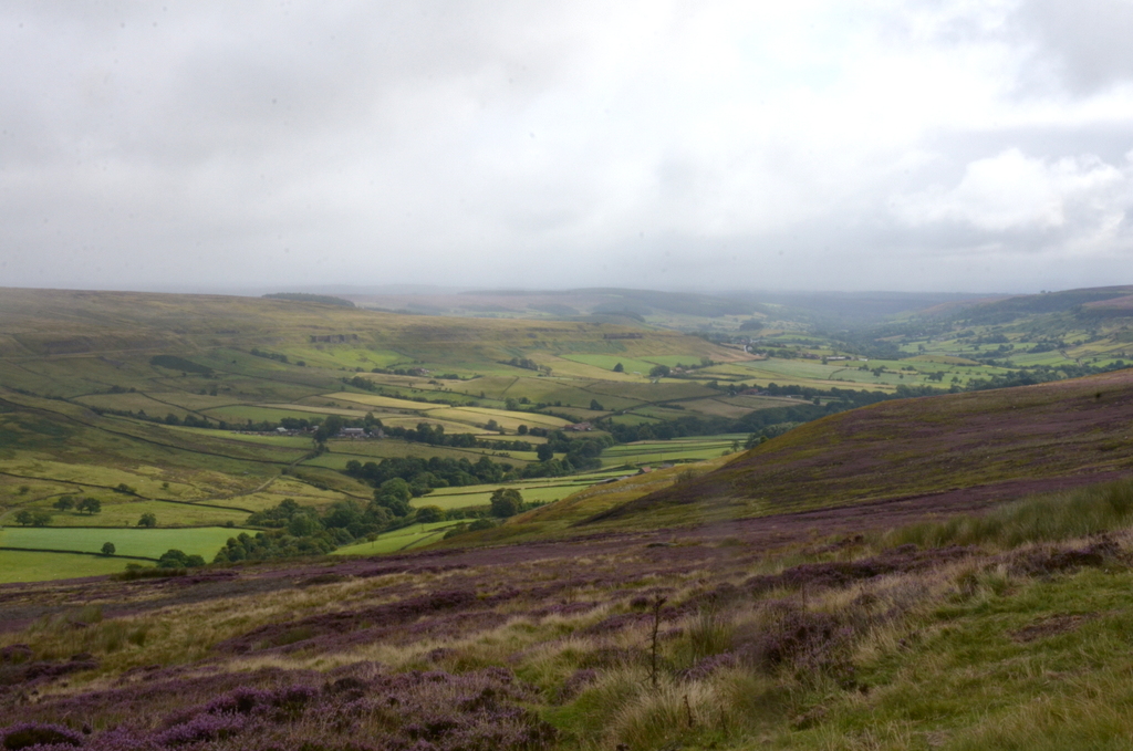
landscape continues to feature moorland and roadways. And ends — bookend-style
— with sea cliffs and a climb down to the beach at Robin Hood's Bay.
This
stage starts nicely with a gradual hike downhill from Glaisdale into the
picturesque hamlet of Egton Bridge, one of the most attractive spots on the entire
Walk.
 |
| A home in a former Post Office -- it still has the post box in the wall |
Two
miles further east is the equally interesting hamlet of Grosmont — less
picturesque, in a traditional sense — but notable for its associations with
steam trains (the North York Moors Railway).
 |
| An old-fashioned train station in Grosmont |
But
now there is the final very steep climb — about 700 feet (230 m) — up to
Sleights Moor. On the way up you can glimpse a view of Whitby Abbey to the
north. At the top you pass the five High Bride Stones, the remnants of a
Bronze-Age stone circle.
 |
| Village sign constructed out of bicycle parts |
Then
you descend gradually through more heather and across Sleights Moor, until you
reach the small village of Littlebeck. Just south of the village you begin a long
stroll through the lovely Little Beck Wood (not so little, actually — it's 65
acres). Half way through the woods you encounter Falling Foss, a
20-metre-high waterfall. There's a tea
garden next to it — should you fancy a cuppa.
 |
| Falling Foss |
 |
| A "cream-tea" at Falling Foss |
At
the end of the woods, you turn sharply north along a road for a bit, and then
strike out across the Sneaton Low Moor and the Graystone Hills. Continue north
to Low Hawsker; and then east to High Hawsker. Soon enough you'll meet the
Cleveland Way right on the coast, overlooking the North Sea.
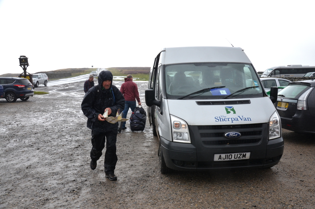
 |
| Checking the route in Stedman's book and the Harvey map |
From
here you turn south-east and follow the sea cliffs into Robin Hood's Bay. Climb
down to the small beach and dip a hiking boot into the North Sea. Hallelujah,
you're done — 190 miles (304 km) across England on the Coast to Coast Walk, through
the Lake District, over the Pennines, and across the North York Moors. Head for
Wainwright's Bar in the Bay Hotel. Sign their visitors' book; and down a pint,
or two, in celebration!

Well
we made it! This was the fourteenth and final day of the Coast to Coast Walk.
And it wasn't an easy end to the adventure: we hiked for about twenty miles
today — the second longest stage in our journey.
 |
| A few more colours of heather on the North York Moors |
The
hiking today featured a little bit of everything we've faced so far: some
walking through the woods on muddy paths (thanks to a couple of days of rain);
a fair bit of road-walking on hard tarmac (not good for the feet); two steep
ascents (especially the one out Grosmont); some walking across fields and
meadows; and trails across the wind-blown, heather-clad moors of the North
Yorkshire Moors National Park.
 |
| Getting closer to Robin Hoods Bay -- it's now on the road signs! |
This
final stage also served as a bookend to the first day's hike: from St Bees, on
the Irish Sea coast, we had hiked north — on that first day a fortnight ago — along
the cliffs of South and North Head; today we approached our destination — the
beach on Robin Hoods Bay — by hiking south along the dramatic cliff-top south
of Whitby.
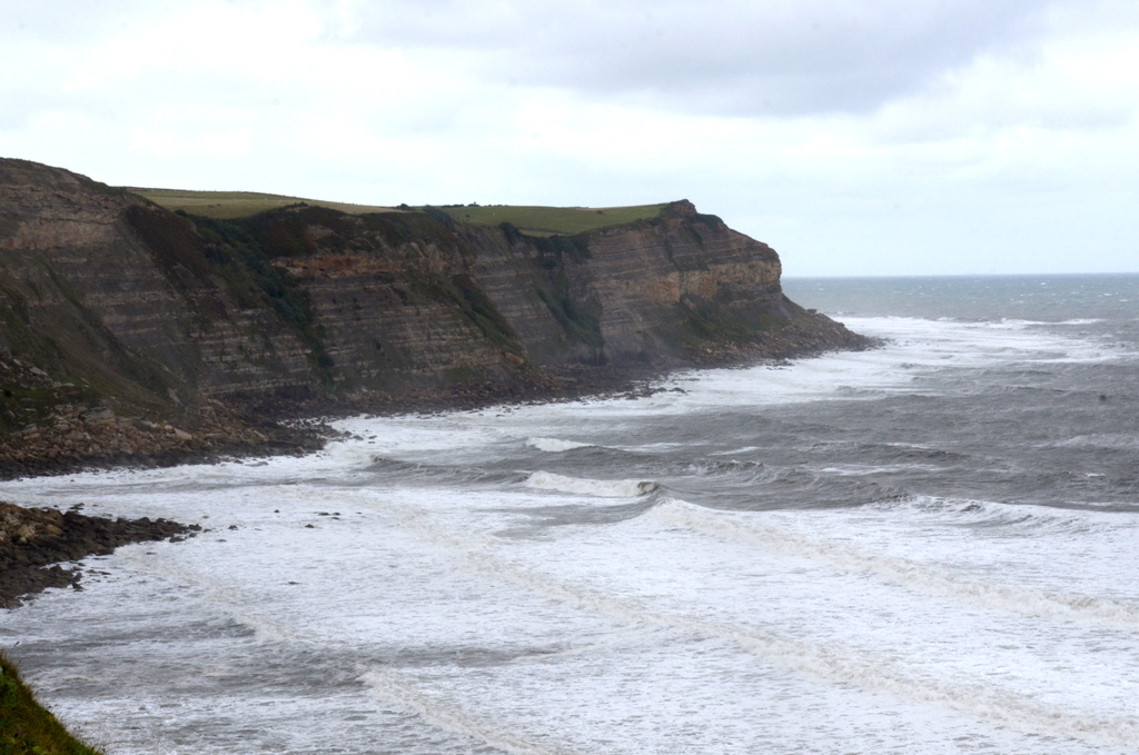 |
| The cliff face north of Robin Hoods Bay |
On
most of this trip's stages we experienced those "are-we-there-yet"
moments, when the physical and mental fatigue really kicks in during the final
two hours. Today was no different. Despite the anticipation of finishing our
fourteen-day trek, and the exhilaration of completing this ambitious adventure,
this day's walk still ended with a tiring hike south along the wind-blown
coastal path. Some of the vistas of the rocky coast were spectacular, but soon
we couldn't help but wish that the shelter of Robin Hoods Day would come soon.

Quote of the Day:
"... how often do any of us walk 14 miles in a day, let alone
continuously for two weeks?"
- Henry
Stedman (explaining that the Coast to Coast Walk is tougher than some people
think)
 |
| Finally, Robin Hoods Bay is visible from the cliffs north of the village |
Eventually,
it did. We marched down the streets of this attractive village towards the
beach — the "official" terminus of the Coast to Coast Walk. The final
stretch in the oldest part of the village was very steep going down — and I
couldn't help thinking that we would soon have to climb back out on our way to
our B&B.
 |
| The final step of the Coast to Coast Walk -- a hiking boot each in the North Sea |
And
then we were at the beach. There were a couple of "obligatory" rituals
I wanted to document with my camera. We each stuck one of our hiking boots into
the Water of the North Sea — as we had at the very beginning of the Walk in St
Bees. And then we took the pebble that we had selected from the strand in St
Bees and tossed it ceremoniously into the North Sea. From west coast to east
coast. Our journey was complete.
 | |||
| Michael tosses his pebble into the North Sea |
 |
| ... then Tony |
 |
| ... my turn |
I
looked for someone to take a photograph of the three of us on the beach. There
was a threesome nearby. One of them agreed quite readily to do so — especially
when I explained that we had just completed the 192-mile Coast to Coast Walk.
He was very impressed, and we had a brief chat as he went about the business of
documenting this final moment.
 |
| Michael, Clive and Tony (left-to-right) at journey's end |
That
done we walked off the beach and into "Wainwright's Bar" in the Bay
Hotel. We trudged tiredly upstairs and ordered three pints of Wainwright Ale.
Before taking our drinks outside, in order to relax for ten minutes in the
fresh air, we signed the Visitors Book. We were tired, but triumphant.
 |
| The Wainwright Bar is in the Bay Hotel -- next to the beach at Robin Hoods Bay |
And
then it was time to head up the steep hill to The Villa — our B&B for the
night in Robin Hoods Bay. My legs felt like they were going to seize up. It was
as though they had decided, independently of my will and spirit, that
one-foot-in-front-of the-other was finally over — walking was done for now and
forever!
After
a long, soothing bath at the B&B, the three of us walked down into the old
part of Robin Hoods Bay again, to enjoy an excellent meal at the Smugglers Inn.
There was much talk amongst us about the thoughts and feelings that filled our
minds and hearts after this incredible fortnight walking across the north of
England — truly one of those "once-in-a-lifetime" experiences.
 |
| Michael signs the Visitors Book |
 |
| Cheers! We're done! |
Thanks
to my good friends Tony and Michael for their companionship and support
throughout this challenging fortnight. We made a good team. And we achieved our
goal with virtually no problems or difficulties — thanks to careful planning
and the dogged pursuit of our goal.

"I finished the
Pennine Way with relief, the Coast to Coast Walk with regret."
-
Alfred Wainwright
 |
| Alfred Wainwright, who created the Coast to Coast Walk in 1972 |
Dedication
This hike is dedicated to
Bill and Barb Cannon.
(see
the end of my blog post for Day One for details)
 |
| Henry Stedman |
Resources:
I am deeply indebted to Henry Stedman's Coast
to Coast Path - Sixth Edition, published by Trailblazer Publications, for
much of the detail in the route summaries; I also used A Coast to Coast Walk - Revised Edition (2003) by A. Wainwright,
published by Frances Lincoln, London; the sectional maps come from Harvey Map XT40: Coast to Coast West (St. Bees to Keld)
and Harvey Map XT40: Coast to Coast East
(Keld to Robin Hood's Bay); the B&B and hotel bookings, and the daily
luggage-ferrying was done by Macs
Adventure. The books and maps can be purchased via amazon.ca or amazon.uk