
"A
journey of a thousand miles begins with a single step."
- Tao Te Ching (Chapter 64)

Day
One: from St Bees to Ennerdale Bridge (15 miles/24 km)
Summary of Route:
The first day of hiking begins at the beach in St. Bees village. St. Bees is in
the north-west of England; it sits on the coast in the county of Cumbria,
facing the Irish Sea. St. Bees is about 5 km south of Whitehaven and 10 km west
of the Lake District National Park border.
From St. Bees the trail
runs north-west along the cliffs, across South Head and North Head (which are
separated by Fleswick Bay), and past the St. Bees Lighthouse. At Birkham's
Quarry the trail turns east and runs through the villages of Sandwith, Moor
Row, and Cleator before climbing steeply about 250 metres up and over Dent
Hill.
The trail descends
steeply down Raven Crag Hill, and then takes you beside Nannycatch Beck, the
River Ehen, and ends at Ennerdale Bridge, right on the edge of the Lake
District National Park.
 |
| Walking to St Bees Beach |
I began today's hike — the
first of fourteen consecutive days of walking (averaging 14 miles/23 km per
day) — with some trepidation. I may do some
walking in my daily life, but I knew I was not fit enough to jump right into
long-distance hiking without having difficulty. It's been over two decades
since I've done days of 25 km walks. And those were not done consecutively! But
I have entered this adventure with the belief that I could quickly acclimatise
to the demands, and build up the stamina and fitness as we went. Who knew,
though, what the first day would bring?
Well, it was more difficult
than I imagined. The first stage on the Coast to Coast Walk is a fairly long
one (15 miles/24 km); and it features a steep ascent of 300 m (about 900 ft)
straight up the south-side of Dent Hill, about two-thirds of the way into the
day's hike. This is followed a little later by an even faster and more
precipitous descent down the north-side. Tired and wobbly-legged, you still
have to walk for another few miles to the day's destination of Ennerdale
Bridge.
 |
| St Bees Beach Coast to Coast sign |
The Coast to Coast Walk
begins on the beach at St Bees. We walked half-a-mile there from our B&B in
the village. Once at the beach we headed straight for the Coast to Coast sign.
It features a schematic map of the route, a brief history and description of
the Walk, and a photograph of Alfred Wainwright, who created the Coast to Coast
path back in 1972.
 |
| Up South Head |
We walked from the sign down
to the water. We dipped a booted foot into the shallow water. And then we
picked up and pocketed two small pebbles from the strand — one to keep as a memento, and one to toss
into the North Sea, when we complete the Walk on September 5th. With that done
we took off, walking to the north end of the beach, crossing a wooden footbridge,
and turning west for a shirt while, before starting a faily steep climb up
South Head along a footpath that hugs the sea cliffs north of St Bees. South
Head is separated from North Head by the small Fleswick Bay. We took an awkward
hike down to the pebbled beach at Fleswick Bay — primarily to get a close-up
view of the redstoned cliff.
 |
| Approaching Fleswick Bay |
From here the path followed
the cliff edge north for quite a distance. The path is eroded quite deeply into
the meadow grass; often, it was easier to step out of the narrow groove, and
walk beside the rutted groove. Whilst keeping a close eye on the path ahead,
you also have to cope with a strong wind that whips across the headland. I had
to put my hat into my backpack. It had already been blown off my head; I didn't
want to see it carried away and down to the Irish Sea.
 |
| A gate on South Head |
 |
| Looking north towards Whitehaven |
We soon passed the
lighthouse near the tip of North Head, and the path began to veer north-east.
Soon enough we could gaze north along the coast — with a tremendous vista of the
Cumbrian town of Whitehaven, just a few miles along the coast. And, then, right
after passing a sandstone quarry, we turned east from the coast and began a
different kind of hiking — along narrow country lanes, and across fields and
meadowland.
 |
| Michael and Clive by the Quarry |
Quote of the Day:
"You'll have to remember,
I am considerably younger than both of you."
- Michael (who was one
year behind Tony and I
at boarding school in the mid-to-late 60s)
 |
| Going under a tunnel beneath an old rail line |
We began to meet other Coast
to Coast hikers on the trail. We tagged along with an Australian couple for
quite a while. Encountering other walkers has two main benefits: interesting conversation
and other opinions when you are not sure in which direction the trail is
leading. Maps and guide books come out of backpacks, and discussion ensues.
 |
| Climbing the 300 m up Dent Hill |
After a couple of hours I
could feel my little toe in each foot getting a bit sore. I was worrying about
blisters developing — a nasty source of discomfort for the long-distance hiker.
Somebody had advised me to wear two pairs of socks —an inner "liner"
and a pair of thicker merino wool socks. Later on, during our lunch-stop, I
removed the "liner" socks, and that seemed to solve the problem.
Either the thin liners were adding just a wee bit too much thickness to the
sock layer, or the toes were rubbing improperly against the skin.
 |
| Tony negotiates his way over a deer stile on Dent Hill |
After about 7 miles, half of
the day's hike, I could begin to feel my legs getting sore. My lack of fitness
was starting to show. It was a case of minor discomfort for a couple of miles,
and an hour or to, but once we hit the steep climb up Dent Hill, I was having a
difficult time coping with the steep ascents and descents. The rest of the hike
that day was an arduous struggle, and I was struggling to hold on as we slowly
marched to our target.
 |
| Nannycatch Beck |
The scenery began in
spectacular fashion, with the hike along the sea cliffs by the Irish Sea. The middle
stretch was less-interesting, as we walked across fields and meadows. But once we
got to the top of Dent Hill, it was spectacular landscape in all directions, as
slowly approahed the Lake District. The vistas up on Dent Hill were wonderful,
and the scenery down in the Valley — as we followed Nannycatch Beck (stream)
towards Ennerdale was beautiful.
 |
| Following the Nannycatch Beck |
Once we got to our B&B,
the mounting stress about the physical challenges was dissipated. I had a long,
hot bath. Several glasses of iced-water, and a pint of local, Ennerdale ale.
Things rapidly improved. And after dinner, I sat in my room to compose this
first post about the Walk. Stay tuned! Tomorrow we move into the Lake District
National Park. We walk from Ennerdale Bridge to Rosthwaite (in Borrowdale).
 |
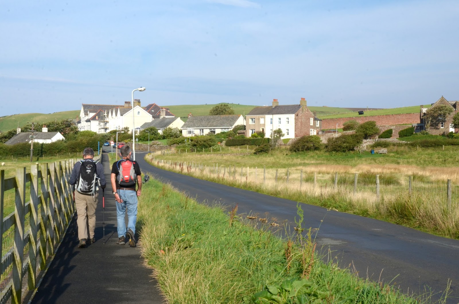
| Approaching Ennerdale Bridge |
Dedication
This
hike is dedicated to Bill and Barb Cannon.
Bill
and Barb are the parents of my good friend Bill Cannon. Barb and Bill were
generous hosts of their children’s friends in the '60s and '70s. They were keen
hikers, and deeply involved with the Bruce Trail Association — specifically,
with the Iroquoia Club, which manages the Trail from Grimsby to Milton.
During
WWII Bill’s father was evacuated as a twelve-year-old in 1939 from Newcastle to
the Lake District in England. It was Bill’s experiences there during the War
which made him an avid hiker and a lover of the Lake District (shades of Alfred
Wainwright!).
Bill
and Barb, and other like-minded British immigrants to Canada in the '50s and
'60s, brought their love of outdoor hiking — “rambling”, they called it back then
— to their new homeland. Many of these immigrants got involved with the nascent
Bruce Trail Association. On many weekends throughout the year Barb and Bill
would lead an afternoon hike along some nearby section of the Bruce Trail. The
family group would often be augmented by several of their children’s friends.
It was on hikes like these,
with the Cannons, that I discovered the joys of hiking in the early 1970s. My
wife Barbara and I began walking the Bruce Trail (in consecutive sections) in
the spring of 1992. By the autumn of the following year, we had hiked along the
escarpment trail from Queenston Heights in Niagara all the way to Hilton Falls,
just north of the 401 — almost a third
(250 km) of the total length from Niagara to Tobermory. The rest, I suppose, is
for the future.
 |
| Alfred Wainwright |
"This is a walk that ought
to be done in comfort and for pleasure or not at all."
-
Alfred Wainwright
From the photographs, I can't believe the weather you're having!! It was pissing it down in Bristol where I was.
ReplyDeleteGlad to see you've made a good start - happy trekking.
Thank you, Clive for dedicating this hike to my parents. Perhaps this fall we will pick some good hikes on the Bruce Trail, so that we can continue the momentum.
ReplyDelete