
"A vigorous
five-mile walk will do more good for an unhappy but otherwise healthy adult
than all the medicine and psychology in the world."
- Paul Dudley White


Day Four: from Grasmere to Patterdale (7.5 miles/12
km)
Summary
of Route: If you ignore the alternative
high-routes, and take the low Grisedale Valley route, this will be the shortest
of the Coast to Coast stages. The highest route, up and over Helvellyn, will
add two hours to your hike.
 |
| Tony and Michael beside Tongue Gill |
From
Grasmere, the trail leads to a footbridge at the bottom of
Great Tongue. Here you face a choice of route: the steeper (western)
alternative follows the Little Tongue Gill; the slightly milder gradient (on
the east side of Great Tongue) follows along Tongue Gill. These alternate paths
meet just above a waterfall. You keep climbing, and soon you arrive at the
scenic mountain lake called Grisedale Tarn.
 |
| Tongue Gill |
And
now you face another choice — there are three alternatives this time: an easy
hike through the Grisedale Valley; a high-route on the south side of the
valley, along a ridge that rises to St Sunday Crag and The Cape (at 841 m),
before descending to Glenamara Park; or the even-higher trail along the
northern side of the valley, which ascends to Helvellyn (at 950 metres, it's
the third highest peak in England, after Scafell Pike and Scafell) and drops a
bit before reaching a very narrow ridge at Striding Edge.
Some
people argue that the St Sunday Crag hike offers better vistas than the
Helvellyn alternative, even if it is not as exciting — for many, the best views
of the entire Coast to Coast Walk. At The Cape you can get a view stretching
out over the next day's objectives: Angle Tarn, Kidsty Pike, and Haweswater.
And, apart from the impressive views, this route offers a much easier climb up
and down the ridge.
 |
| Waterfall on Tongue Gill |
The
climb on the other high route, up and over Helvellyn, is an arduous one, and
the narrow ridge at Striding Edge can be nerve-wracking, especially when the
wind is blowing. But Wainwright extols the virtues of this particular stretch of
the trail: he calls Striding Edge "the best quarter mile between St Bees
and Robin Hood's Bay." And it was his climb to Helvellyn during his first
visit to the Lake District in 1930 that got him hooked on fellwalking in
Lakeland. So the extra distance and time (two more hours) required to negotiate
this dramatic piece of hiking ought to be well worth the effort.
 |
| Looking south back toward Tongue Gill |
The
three alternate routes meet close to each other at Glenamara Park. From here
you get good views of Patterdale village and Ullswater. And then it's a short
walk down into Patterdale.
 |
| Michael by waterfall on Tongue Gill |
Today's
hike was dominated by the weather. We have been lucky so far to have had lots
of sun, or periods of sun mixed with cloud, and sometimes overcast skies. But
no rain — until today. Last night, when we were coming back from the restaurant,
it was raining; we had to dash to avoid getting too wet. It continued to rain
overnight, and it was still raining when we came down for breakfast. So, just
before leaving we donned our rain gear — light jackets (with hoods), pants
(trousers), and waterproof covers to pull over our backpacks.
 |
| After climbing al the way up past Great Tongue, we reached Grisedale Tarn |
The
rain kept coming down for the first 20 minutes of the walk, as we followed the
A591 north-west out of Grasmere. But it stopped soon after we turned east off
the road and began a long hike up a bridleway beside the Tongue Gill stream.
For the next few hours the trail was wet and slippery, with shallow water
running over the stones, rock and gravel. All along the route the brooks and
streams cascading down the fells were engorged with extra water from the
extended rainfall — creating sustained stretches of white water and impressive
waterfalls. And the rocks that usually help one in fording over a stream crossing
the path were virtually covered by the rushing water, making one's footing a
little tricky — you had to take your time.
 |
| Grisedale Tarn -- just past the eastern end the wind began to blow with gale-force speed |
We
reached a trail-divide at a footbridge and took the path that cuts east around
Great Tongue, following the Tongue Gill stream. The climb got steeper, and we
continued to watch our step over the slippery rocks that have been placed to
assist your climb upward.
Quote of the Day:
"May the force be with you"
- Michael
(in the
Lake District the term force refers to rapids or waterfall)
 |
| After the incredible winds at the top of the Grisedale valley, we hiked down -- stopping beside the Ruthwaite Lodge; the Ruthwaite Beck flows down the fell into the Grisedale Beck at the bottom of the valley. |
At
the top of our climb we reached the Grisedale Tarn — a small lake created by
glacial gouging of the upper fells. The wind was blowing strongly and there
were whitecaps flowing rapidly eastwards over the surface of the lake. We hiked
to the eastern end of the tarn and prepared to begin our descent down into the
Grisedale Valley. And then the wind picked up — to almost gale-force power. The
waterproof cover wrapped around Michael's backpack was ripped off by a large
gust of wind and was blown across the sodden grass towards the stream. Michael
left the trail in hopes of retrieving the cover, but the wind sent it rapidly
down the valley and it disappeared. Michael gave it up for lost. Tony and I
provided some brief grief-counselling, and the issue — Michael conceded — had gained
some closure.
 |
| Ruthwaite Beck |
As
we continued down the path, we were continually buffeted by some incredible
blasts of wind. Many times I had to plant myself firmly, using the walking
poles as a means to keep my balance. The problem was made worse by the very wet
rocks we were clambering over, and the fact that we were working our way fairly
steeply downhill. When it came time to choose one of three alternate routes
down to Patterdale, following the Grisedale Beck, we did not hesitate to avoid
the two high-ridge routes, and chose instead the easier path through the
valley. We could see some of the ridges immersed in cloud, and the wet and extremely
windy conditions made the high routes too hazardous. Taking the low route made
this the shortest stage thus far, and we reached Patterdale by 1:30 p.m. — only
four-and-a-half hours of hiking.
 |
| Wooden bridge over the Grisedale Beck |
I
became especially aware today of the familiar patterns that one's thoughts and
feelings go through when you are engaged in long-distance hiking. At times you feel great — touched by
exhilaration at the challenge, and full of the physical delights of breathing
fresh mountain-air and feeling the sun on your skin and the wind in your face.
But then you experience moments of doubt and anxiety: what the hell am I doing?
— can I really get all the way through this challenge? Your mind focuses, in
turn, on different aches and pains — the sore spots on your feet, that you
think might become blisters, the aches in your leg muscles, the small pain
above your left ankle caused by a
too-tight boot. And so it goes — alternating feelings of confidence and
concern.
 |
| Nethermostoove Beck |
All
of our overnight accommodations have promised wi-fi connections. Already the
situation at two locations has been disappointing — limited access, and
sometimes only in certain areas of the building. I couldn't complete and upload
the previous blog post from Grasmere because of that. Fortunately, today's
B&B has an excellent connection and I've tried to complete my reports
for Day 3 and 4 here.
 |
| A couple of rams in the Grisedale Valley |
Tomorrow
we do the final stage inside the Lake District National Park. We are going to
walk from Patterdale to Shap. When we arrive at our destination, we will just
outside the eastern boundary of the Lake District. The final day of steep
hiking up and down the fells.
 |
| Looking up to Nethermost Pike from the spot we stopped for lunch. |
"Perhaps the
truth depends on a walk around the lake"
- Wallace
Stevens

Dedication
This hike is dedicated to
Bill and Barb Cannon.
(see
the end of my blog post for Day One for details)
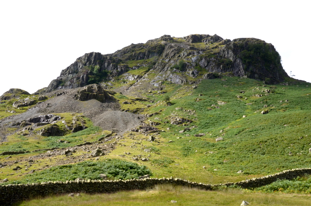 |
| The Grisedale Brow |
Resources:
Coast
to Coast Path (Sixth Edition - 2014) by Henry
Stedman;
Coast to Coast: West
- Harvey Map XT40
 |
| A copse of pines just before we arrived in Patterdale. |
Nice pics, Clive.
ReplyDeleteDave
Back from our own adventures in PQ and finally catching up with your blog diary Clive. Interesting to see the pics and hear ur thoughts on the walk - esp.on the fluctuations in your thinking - from confidence to concern. Keep it up and may the wind be at your back! cheers rk
ReplyDeleteMy ancestor built the stone Grisedale Bridge near Patterdale 116 years ago.
ReplyDelete